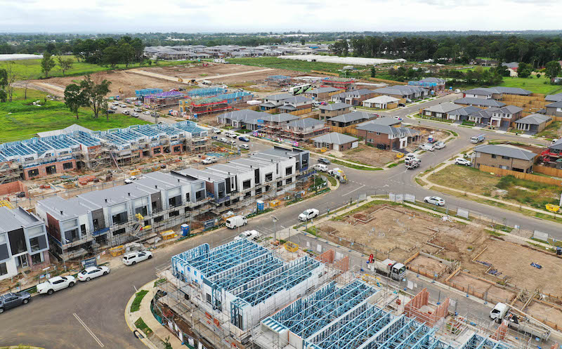
Residential development construction in the Leppington North precinct.
Austral and Leppington North have been rezoned by the NSW Government as part of the South West Growth Area. Liverpool City Council is now responsible for overseeing the delivery of this precinct based on the adopted plans. Local developers will be responsible for building most new roads and upgrading other streets to facilitate and support their development.
Austral and Leppington North fall within the Liverpool and Camden Local Government Areas (LGAs) and will accommodate at least 17,350 homes once developed. More than 2000 new lots have been registered since the precinct was rezoned. Lots are currently being registered at a rate of about 175 per quarter.
Planning for Austral and Leppington North has been informed by several technical planning studies. These were carried out by the Department of Planning, Industry and Environment, and are available on their website.
Planning the future of Austral and Leppington - The Indicative Layout Plan
Council assesses development and will deliver infrastructure that is informed by the masterplan for the Austral and Leppington North precinct. This plan is known as the Indicative Layout Plan (ILP) and shows how each rural acreage site will be developed over time to provide for a high-quality liveable community. Key features of the ILP, including the road network, land use precinct, and the locations of parks and drainage is shown below.
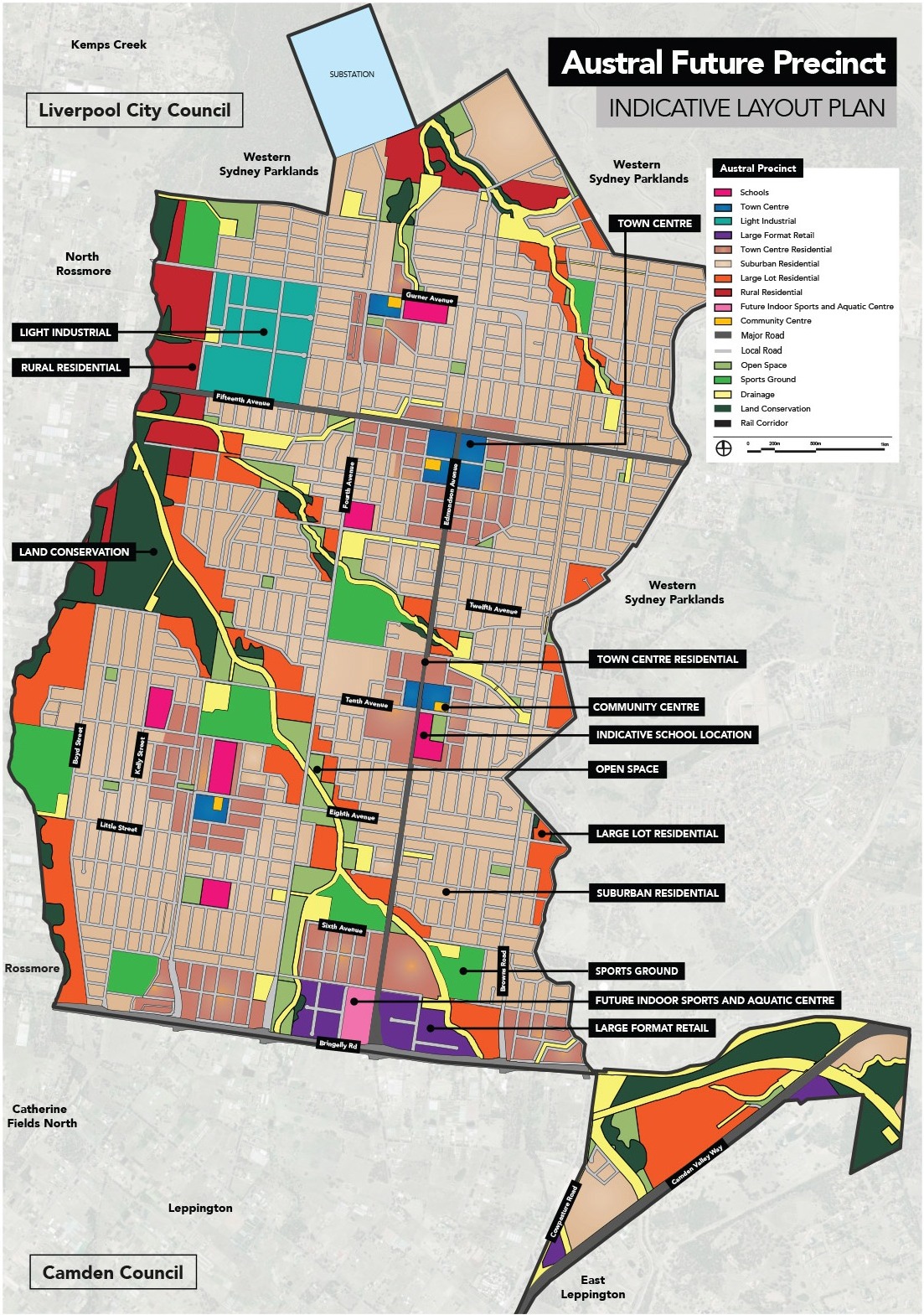
Austral Future Precinct - Indicative Layout Plan (ILP)
The ILP is a long-term strategy and shows how the precinct will function when it is fully developed. It provides information regarding the location of land for a variety of uses, including: new homes, shopping areas, new parks and open spaces, stormwater infrastructure, community facilities, and new and upgraded roads. With the development that has already occurred in Austral and Leppington North, we are seeing the ILP come to life.
Visit the FAQ page for more information on growth-area planning, the process of development in growth areas and how Council is addressing some of the common issues encountered in these growing areas.
Infrastructure Delivery
Council is responsible for delivering stormwater infrastructure, most public open spaces, community facilities, and some roads. Given the size and scale of the Austral and Leppington North precincts, Council will prioritise the delivery of this infrastructure, considering safety, accessibility, and the opportunity to provide interim services.
Read on for more details about how Council and other organisations will improve amenity and liveability in Austral and Leppington North through zoning and infrastructure investment.
Trunk drinking water and wastewater utilities (including mains and pumping stations) are to be delivered by Sydney Water. Council is working with Sydney Water to accelerate the delivery of this critical infrastructure across Austral. At present, only certain areas of Austral are serviced, and additional capacity is constrained. More information about the delivery of water services can be found on Sydney Water’s website:
Road improvements
The ILP identifies the road network for Austral and Leppington North. An extract of the ILP focusing on the road network is provided below.
Several existing roads within the Precinct will be upgraded, with some major roads already upgraded including: Bringelly Road, Camden Valley Way and parts of Denham Court Road.
Local roads will be progressively upgraded as areas develop. The ILP anticipated approximately 3,300,000m2 of local roads within the precinct, of which Council will deliver 6.3%. The remaining roads will be delivered by developers.
For more information on how road infrastructure is delivered in release areas, visit Council’s FAQ page.
Design investigations are underway for the upgrade of Edmondson Avenue to provide a transit boulevard connecting centres in Austral, Leppington Station and Fifteenth Avenue. Preliminary investigations are underway for the upgrade of Fifteenth Avenue as part of Council's Fifteenth Avenue Smart Transit Corridor project. Council is advocating for the FAST Corridor to be a high-quality public transport link between the Liverpool city centre, the future Western Sydney International Airport and the Bradfield Aerotropolis. Further information about the Fifteenth Avenue Smart Transit Corridor is available here.
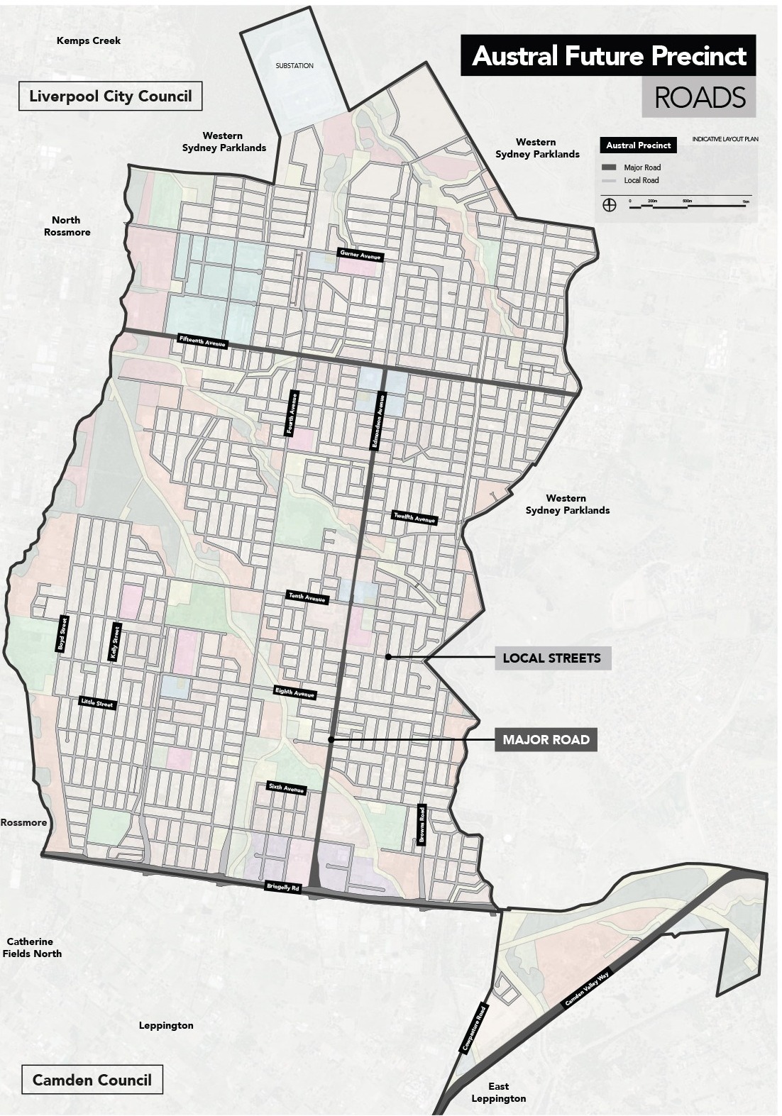
ILP map highlighting roads to be /have been delivered as per SIC, and roads to be delivered by Council.
Public Transport
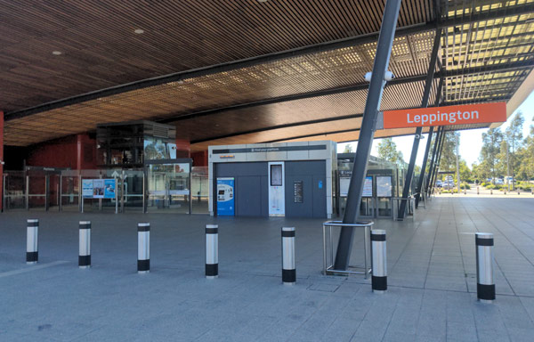
Leppington Station and bus interchange.
This area has limited bus routes. However, there is a direct train service from Leppington Station, connecting to the key regional job hubs of Liverpool and Parramatta, and direct services to the Sydney CBD. Council is in discussion with Transport for New South Wales to introduce a new bus route connecting areas in Austral with Edmondson Park and Carnes Hill.
The NSW Government provides commuter parking at train stations and is constructing a new multi-level commuter car park at Leppington. It will provide up to 1000 additional parking spaces, with work scheduled for completion in mid-2021.
As Austral and Leppington North develop, Council will need to acquire more than 50 hectares of land for new stormwater detention basins, drainage channels, creeks and other water management infrastructure. An extract from the ILP below identifies the location of all drainage infrastructure within the Precinct.
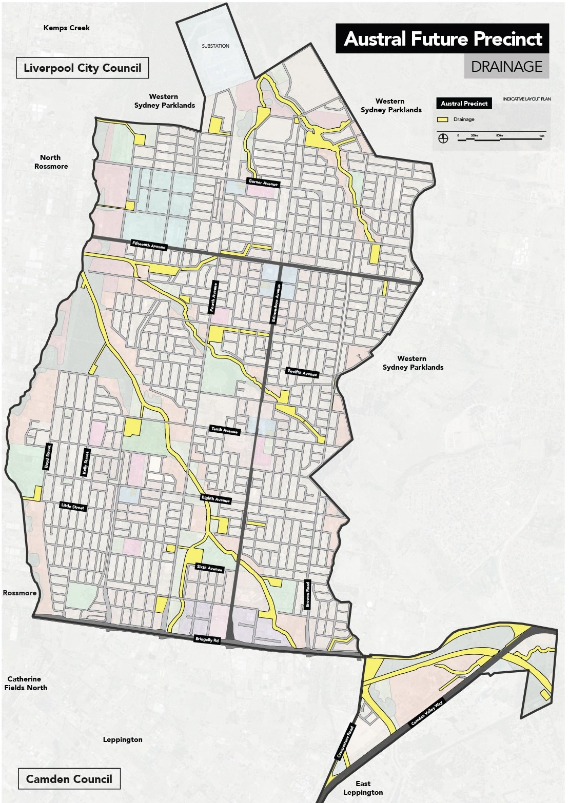
ILP map highlighting location of basins and creeks/drainage channels Austral.
This infrastructure is essential to protect residents and businesses from flooding. New infrastructure will also be built to ensure that stormwater entering our creeks is filtered from litter and other nutrients, improving the health of our waterways.
Council is also planning to incorporate more recreation, walking and cycling opportunities next to creeks and flood basins. This dual-use of public land makes the provision of community infrastructure more efficient.
For more information on the delivery of stormwater infrastructure, visit Council’s FAQ page.
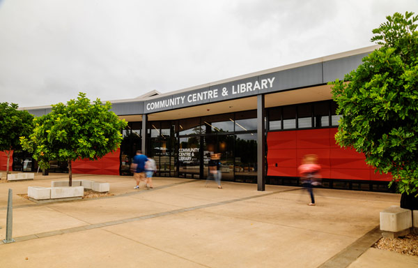
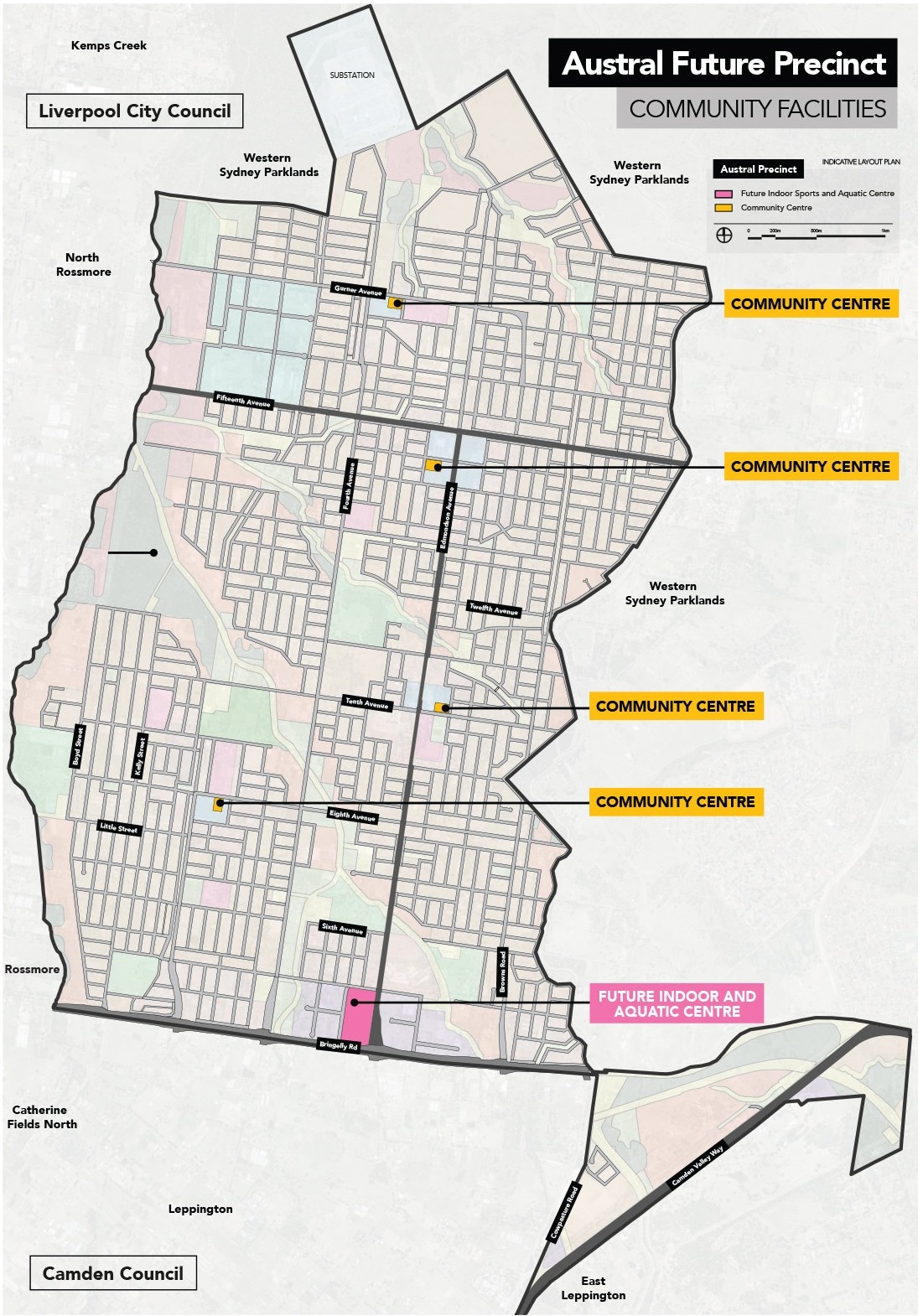
Community facilities
Three local community facilities are being planned in Austral. Investigations are underway to determine their functions, including: community meeting rooms, creative arts spaces, or halls for hire. Facilities will be located at the intersection of Fourth and Gurner Avenues, the intersection of Tenth and Edmondson Avenues, and the western end of Eighth Avenue. This ensures that they will all be located within a town centre at key road intersections.
A larger and more central district facility is under investigation at the intersection of Edmondson and Fifteenth Avenues. This facility has the potential to include a library, function space, customer enquiry desk, and an early education and care centre.
Carnes Hill Community and Recreation Precinct.
A regional indoor sports and aquatic facility is identified at Scott Memorial Park.
Additionally, a regional community facility is planned within the Leppington Town Centre. This facility is within the Camden LGA and it is anticipated that Liverpool City Council will be involved when Camden Council begins the design of this facility.
Open space
The ILP outlines where existing and future open spaces will be located. Council’s Capital Works program is updated every year, and a map showing 2023 - 2024 works. Current works for the Austral area can be found on Austral Open Space Planning page.
Approximately 100 hectares of public open space will be delivered by Council in Austral and Leppington North as the precinct develops. The new facilities will include playgrounds, walking trails and sporting fields. When the suburb is fully built, most new residents will be within 400 metres of a park.
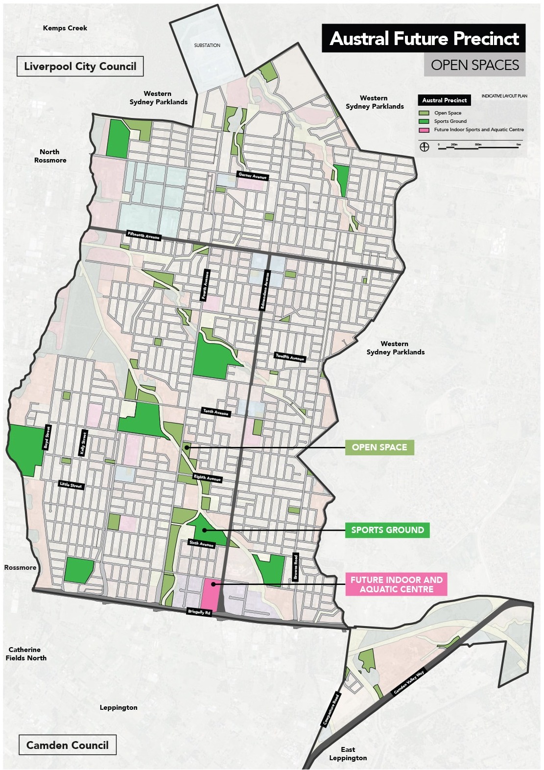
ILP map highlighting location of open spaces in Austral.
Recreation facilities are available at Scott Park, located on the Corner of Edmondson and Fifth Avenues, or Craik Park, located on the corner of Fourth and Eleventh Avenues.
While additional open space facilities are being developed, Council is investigating opportunities to provide temporary pop-up parks and other interactive installations.
The ILP, at the top of this page, identifies the sites of current or future government schools. While many school sites have been reserved in the suburb of Austral, the NSW Department of Education is responsible for the planning and delivery of school infrastructure in the suburbs of Austral and Leppington. There is one government primary school at present - Austral Public School, located on Edmondson Avenue, between Ninth and Tenth Avenues.
There are three non-government schools, operating across primary and secondary education levels in Austral. These are Al-Faisal College Liverpool on the corner of Gurner and Fourth Avenues; St Anthony of Padua Catholic School on Eleventh Avenue, between Edmondson and Fourth Avenues; and Unity Grammar, on Fourth Avenue, between Fifth and Sixth Avenues.
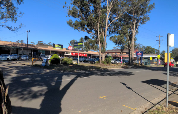
Current Austral Shops on Edmondson Avenue.
Four centres have been zoned for shops in Austral and Leppington North within the Liverpool Local Government Area, as seen in the extract of the ILP below. This includes the existing centres on Edmondson Avenue (one near Fifteenth Avenue and another on Tenth Avenue), as well as new centres at:
- the intersection of Gurner Avenue and Fourth Avenue; and
- the western end of Eighth Avenue, where it intersects with a future key road.
The Leppington Town Centre is also planned as a key commercial centre and has land zoned for a broad range of uses.
Retail centres in Austral and Leppington North have been planned to be co-located with future community facilities, open spaces and plazas, and public transport routes to ensure that they are accessible and provide a range of services for residents.
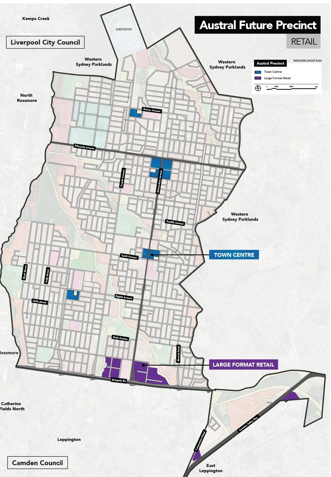
ILP map highlighting location of commercial zones in Austral.