Stormwater Quality Management
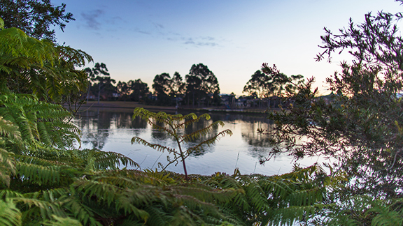
The waterways are under pressure from past and existing developments, catchment disturbance and hydrological modification, land use transformation and large-scale vegetation changes. The population of Liverpool is projected to undergo another period of significant growth as a result of major infill developments and new urban release areas within western areas of Liverpool. The projected growth and associated development will produce significant pollution loads into the waterways. Without appropriate strategy to manage issues associated water quality and ecological health of waterways and wetlands, there would be substantial adverse impact on the environment and the community.
On-going water quality protection is aided by a systematic approach to catchment-based water quality planning and management. Council has developed the Water Quality Management Strategy, which is a key element of Council’s water management planning process and provides a framework for undertaking water quality improvement projects in a coordinated manner. The key water related actions include Gross Pollutant Trap (GPT) Master Plan, guideline for Water Sensitive Urban Design (WSUD) provisions in new development, water quality treatment systems installed by Council as part of road, footpath and park upgrades, Environment Restoration Program (ERP) strategy and riparian zone management. All developments within the LGA must comply with the water quality improvement targets and controls stipulated in Council’s DCP.
Water Sensitive Urban Design (WSUD) is an urban water cycle method that considers and mimics the natural water cycle.
WSUD:
- Treats stormwater as a resource
- Mimics natural processes in the control of stormwater
- Manages water in a sustainable manner through considering the complete water cycle
- Is carefully designed, constructed and maintained to minimise impacts on the natural water cycle.
WSUD makes it possible to:
- Maintain and restore natural water balance
- Reduce flood risk in urban areas
- Reduce erosion of waterways, slopes and banks
- Improve water quality in streams and groundwater
- Use water resources more efficiently
- Reduce costs associated with maintenance of water infrastructure
- Protect and restore aquatic and riparian habitats
- Protect the scenic, landscape and recreational values of waterways.
Austral and Leppington North is the latest land release area in the Liverpool Local Government Area (LGA) for residential developments. Regional flood detention basins with collocated biofilters and streetscape raingardens have been proposed to control water quality within the precinct and the receiving water bodies.
Council will provide trunk drainage and regional detention basins with collocated biofilters to ensure flood risk is not increased and water quality is maintained as a result of development. In addition to this, Council will provide streetscape raingardens to treat stormwater runoff from new roads and adjoining developments. The land-developer will be responsible for delivering an interim silt trap device in accordance with Streetscape Raingarden Master Plan for Austral and Leppington North.
WSUD Masterplan for Austral & Leppington Nth - Final Combined
Good water quality is vital for the health of humans and our ecosystem. Water quality is mainly affected by pollution, poor land use and unsatisfactory management practices.
Nutrients such as phosphorous and nitrogen are a major cause of freshwater algal blooms which can degrade waterways and restrict its use. Nutrient pollution is often caused by sediment problems as nutrients such as phosphorous often enter the waterway attached to sediment particles. This means that erosion caused by the loss of vegetation and range of land uses is likely to be a major source of nutrients. Other sources include sewage discharges and overflows and intensive livestock industries.
Turbidity is a measure of how many sediment particles have entered into a waterway. Liverpool’s waterways naturally have a high level of turbidity due to clay based soils. The particles are readily transported into streams during storms where they remain suspended in the water. This natural level of turbidity however has increased by the amount of sediment entering the waterways after land clearing. A high level of turbidity limits the amount of light available for plant growth and animals to function.
Additionally, a wide range of toxicants, including hydrocarbons, trace metals, pesticides and herbicides are entering our waterways and their long term effects are still unclear.
An increased effort is required to improve water quality. Council is working to mitigate the potential impacts of water pollution through good land use planning, whilst developing a new monitoring program. The new monitoring program will help Council assess whether water quality targets are being met and the results will be vital in determining the success of measures to improve water quality and will enable Council to identify further priorities and actions.
You can also play a part in helping to improve the water quality of our local waterways by:
- Not using the sink to dispose of harmful materials such as oils and grease, medicines and other chemicals;
- Composting food scraps or putting them in the bin rather than washing them down the sink;
- Using washing detergents with low or no phosphorous and using them in small amounts;
- Washing cars on the lawn or at a car wash where the water is recycled;
- Cleaning up animal waste and disposing of it in the bin.
2021 |
|---|
Download the Liverpool Waterway Health October - December Report Card |
Download the Liverpool Waterway Health April - June Report Card |
Download the Liverpool Waterway Health January - March Report Card |
2020 |
|---|
| Download the Liverpool Waterway Health October - December Report Card |
| Download the Liverpool Waterway Health July - September Report Card |
| Download the Liverpool Waterway Health April - June Report Card |
| Download the Liverpool Waterway Health January - March Report Card |
2019 |
|---|
| Download the Liverpool Waterway Health July - October-December Report Card |
| Download the Liverpool Waterway Health July - September Report Card |
| Download the Liverpool Waterway Health April - June Report Card |
| Download the Liverpool Waterway Health January - March Report Card |
| 2024 |
|---|
| Download the February 2024 Aquatic Ecosystem Monitoring Report |
| Download the January 2024 Aquatic Ecosystem Monitoring Report |
| 2023 |
|---|
| Download the December 2023 Aquatic Ecosystem Monitoring Report |
| Download the November 2023 Aquatic Ecosystem Monitoring Report |
| Download the October 2023 Aquatic Ecosystem Monitoring Report |
| Download the September 2023 Aquatic Ecosystem Monitoring Report |
| Download the August 2023 Aquatic Ecosystem Monitoring Report |
| Download the July 2023 Aquatic Ecosystem Monitoring Report |
| Download the June 2023 Aquatic Ecosystem Monitoring Report |
| Download the May 2023 Aquatic Ecosystem Monitoring Report |
| Download the April 2023 Aquatic Ecosystem Monitoring Report |
| Download the March 2023 Aquatic Ecosystem Monitoring Report |
| Download the February 2023Aquatic Ecosystem Monitoring Report |
| Download the January 2023 Aquatic Ecosystem Monitoring Report |
Georges Riverkeeper is the business name of the Georges River Combined Council’s Committee (GRCCC). Formed in 1979 by councils with a collective responsibility for the health of the Georges River to work together to improve its environmental condition and ongoing management.
The eight member councils – Bayside Council, Campbelltown City Council, City of Canterbury Bankstown, Fairfield City Council, Georges River Council, Liverpool City Council, Sutherland Shire Council and Wollondilly Shire Councils – of the Georges River catchment make up the Georges Riverkeeper.
Each participating Council has adopted the Georges River Coastal Zone Management Plan, which includes a range of actions to manage and improve the condition of the Georges River estuary and protect and rehabilitate the river.
Georges Riverkeeper’s activities focus on five main Programs to guide best practice management to protect natural resources and improve liveability along the Georges River:
- Catchment Actions
- River Health Monitoring
- Stormwater
- Research
- Education and Capacity Building
You can find more information about these programs in the Georges Riverkeeper Strategic Plan 2018-2022.
Georges River Combined Council’s Committee Incorporated is an independent and non-for-profit organisation governed by the Georges Riverkeeper Executive Group, who is elected annually and meet monthly.
A General Meeting is held four or five times per year and is attended by Georges Riverkeeper staff, Host Manager, member councils nominated representative Councillors, council staff and community representatives.
Georges Riverkeeper is one of Australia’s longest serving catchment management groups.
If you would like to know more about Georges Riverkeeper and the State of the Georges River please visit georgesriver.org.au.